From Wikipedia, the free encyclopedia
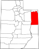
Location of Uintah County in Utah This is a list of the National Register of Historic Places listings in Uintah County, Utah .
This is intended to be a complete list of the properties and districts on the National Register of Historic Places in Uintah County , Utah , United States . Latitude and longitude coordinates are provided for many National Register properties and districts; these locations may be seen together in a map.[1]
There are 20 properties and districts listed on the National Register in the county, including 2 National Historic Landmarks .
This National Park Service list is complete through NPS recent listings posted May 10, 2024. [2]
Current listings [ edit ]
[3] Name on the Register[4]
Image
Date listed[5]
Location
City or town
Description
1
Bank of Vernal Bank of Vernal December 4, 2008 (#08001155 ) 3 W. Main St. 40°27′21″N 109°31′43″W / 40.4557°N 109.52855°W / 40.4557; -109.52855 (Bank of Vernal ) Vernal
2
Carter Road Upload image May 21, 2001 (#00000354 ) Ashley National Forest 40°43′11″N 109°43′10″W / 40.719722°N 109.719444°W / 40.719722; -109.719444 (Carter Road ) Ashley National Forest 1881-built military road in Uintah County and Daggett County
3
Cockleburr Wash Petroglyphs Upload image September 4, 1980 (#80003974 ) Address Restricted[6] Jensen
4
Lewis Curry House Lewis Curry House July 26, 1982 (#82004166 ) 189 S. Vernal Ave. 40°26′39″N 109°31′39″W / 40.444167°N 109.5275°W / 40.444167; -109.5275 (Lewis Curry House ) Vernal
5
Desolation Canyon Desolation Canyon November 24, 1968 (#68000057 ) Along the Green River in western Uintah County between Ouray and Green River, about twice as close to Ouray[7] 39°30′01″N 110°01′19″W / 39.500278°N 110.021944°W / 39.500278; -110.021944 (Desolation Canyon ) Ouray Split between Emery, Grand, Carbon, and Uintah counties
6
Dine-A-Ville Dinosaur Dine-A-Ville Dinosaur November 13, 2023 (#100009526 ) 905 E. Main Street 40°27′22″N 109°30′40″W / 40.4562°N 109.5112°W / 40.4562; -109.5112 (Dine-A-Ville Dinosaur ) Vernal AKA Dinah the Pink Dinosaur.
7
Earl Douglass Workshop-Laboratory Earl Douglass Workshop-Laboratory December 19, 1986 (#86003400 ) U.S. Route 40 40°26′26″N 109°18′04″W / 40.440556°N 109.301111°W / 40.440556; -109.301111 (Earl Douglass Workshop-Laboratory ) Dinosaur National Monument
8
Fenn-Bullock House Fenn-Bullock House March 25, 1999 (#99000401 ) 388 W. 100 North 40°27′26″N 109°32′07″W / 40.457222°N 109.535278°W / 40.457222; -109.535278 (Fenn-Bullock House ) Vernal
9
Gibson-Sowards House Gibson-Sowards House November 24, 1997 (#97001465 ) 3110 N. 250 West 40°30′05″N 109°31′59″W / 40.501389°N 109.533056°W / 40.501389; -109.533056 (Gibson-Sowards House ) Vernal
10
Little Brush Creek Petroglyphs Upload image March 15, 1976 (#76001837 ) Address Restricted[6] Vernal
11
Manfred and Ethel Martin House Manfred and Ethel Martin House December 29, 2004 (#04001422 ) 163 N. Vernal Ave. 40°27′28″N 109°31′41″W / 40.457778°N 109.528056°W / 40.457778; -109.528056 (Manfred and Ethel Martin House ) Vernal
12
McConkie Ranch Petroglyphs McConkie Ranch Petroglyphs September 25, 1975 (#75001828 ) Southeast of Dry Fork 40°32′55″N 109°38′17″W / 40.548611°N 109.638056°W / 40.548611; -109.638056 (McConkie Ranch Petroglyphs ) Vernal
13
Josie Bassett Morris Ranch Complex Josie Bassett Morris Ranch Complex December 19, 1986 (#86003394 ) U.S. Route 40 40°25′31″N 109°10′31″W / 40.425278°N 109.175278°W / 40.425278; -109.175278 (Josie Bassett Morris Ranch Complex ) Dinosaur National Monument
14
Quarry Visitor Center Quarry Visitor Center December 19, 1986 (#86003401 ) U.S. Route 40 40°26′33″N 109°18′05″W / 40.4425°N 109.301389°W / 40.4425; -109.301389 (Quarry Visitor Center ) Dinosaur National Monument
15
St. Paul's Episcopal Church and Lodge St. Paul's Episcopal Church and Lodge January 3, 1985 (#85000049 ) 226 W. Main St. 40°27′21″N 109°31′57″W / 40.455833°N 109.5325°W / 40.455833; -109.5325 (St. Paul's Episcopal Church and Lodge ) Vernal
16
William and Emily Siddoway House William and Emily Siddoway House April 5, 2006 (#06000231 ) 1055 N. Vernal Ave. 40°28′16″N 109°31′44″W / 40.471111°N 109.528889°W / 40.471111; -109.528889 (William and Emily Siddoway House ) Vernal
17
Francis 'Frank' and Eunice Smith House Francis 'Frank' and Eunice Smith House March 29, 2001 (#01000317 ) 1847 N. 3000 West 40°28′24″N 109°35′12″W / 40.473333°N 109.586667°W / 40.473333; -109.586667 (Francis 'Frank' and Eunice Smith House ) Maeser
18
Vernal Tithing Office Vernal Tithing Office January 25, 1985 (#85000286 ) Northwestern corner of 500 West and 200 South 40°27′11″N 109°32′16″W / 40.453056°N 109.537778°W / 40.453056; -109.537778 (Vernal Tithing Office ) Vernal
19
Washington School-Vernal LDS Relief Society Hall Washington School-Vernal LDS Relief Society Hall December 29, 2004 (#04001423 ) 252 N. 500 West 40°27′34″N 109°32′13″W / 40.459444°N 109.536944°W / 40.459444; -109.536944 (Washington School-Vernal LDS Relief Society Hall ) Vernal
20
Whiterocks Village Site Upload image January 1, 1976 (#76001838 ) Address Restricted[6] Whiterocks
See also [ edit ] References [ edit ]
^ The latitude and longitude information provided in this table was derived originally from the National Register Information System, which has been found to be fairly accurate for about 99% of listings. Some locations in this table may have been corrected to current GPS standards.
^ National Park Service, United States Department of the Interior , "National Register of Historic Places: Weekly List Actions" , retrieved May 10, 2024.
^ Numbers represent an alphabetical ordering by significant words. Various colorings, defined here , differentiate National Historic Landmarks and historic districts from other NRHP buildings, structures, sites or objects.
^ "National Register Information System" . National Register of Historic Places National Park Service . April 24, 2008.^ The eight-digit number below each date is the number assigned to each location in the National Register Information System database, which can be viewed by clicking the number.
^ a b c Some listings on the NRHP are highly sensitive sites and may be subject to looting or vandalism. The NRHP lists this site as "Address Restricted."
^ Location and coordinates derived from its GNIS entry ; the NRIS lists the site as "Address unknown"
External links [ edit ] National Register of Historic Places in Uintah County, Utah at Wikimedia Commons
Topics Lists by state Lists by insular areas Lists by associated state Other areas Related