
File:Long-beach-san-pedro-map.png
Size of this preview: 463 × 599 pixels. Other resolutions: 185 × 240 pixels | 371 × 480 pixels | 593 × 768 pixels | 791 × 1,024 pixels | 1,700 × 2,200 pixels.
Original file (1,700 × 2,200 pixels, file size: 116 KB, MIME type: image/png)
| This is a file from the Wikimedia Commons. Information from its description page there is shown below. Commons is a freely licensed media file repository. You can help. |
Summary
| Description |
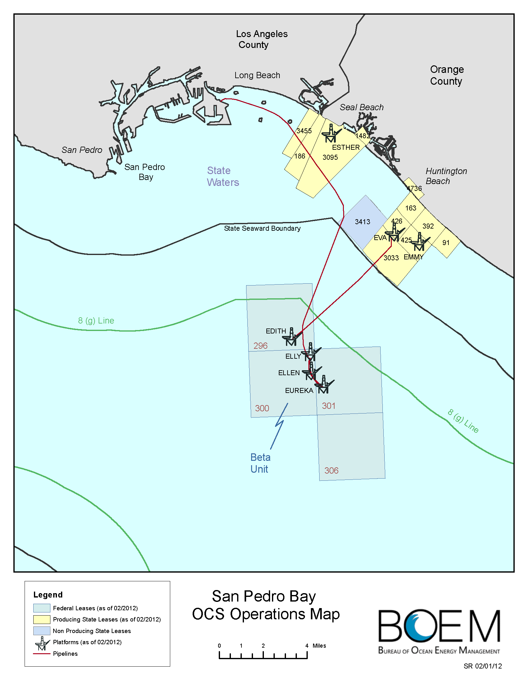
English: Oil platforms in the Long Beach area. The four small islands shown in Long Beach Harbor are artificial islands for oil and gas wells. |
| Date | |
| Source | http://www.boem.gov/uploadedFiles/BOEM/Oil_and_Gas_Energy_Program/Leasing/Regional_Leasing/Pacific_Region/Leasing/long-beach-san-pedro-map.pdf |
| Author | US Bureau of Ocean Energy Management |
| Other versions |
_and_Ester,_Emmy,_Eva_(state_leases)_(cropped).png)
Licensing
| This image or media file contains material based on a work of a United States Department of the Interior employee, created as part of that person's official duties. As a work of the U.S. federal government, such work is in the public domain in the United States. See the Department of the Interior copyright policy for more information. |  |
File history
Click on a date/time to view the file as it appeared at that time.
| Date/Time | Thumbnail | Dimensions | User | Comment | |
|---|---|---|---|---|---|
| current | 15:32, 10 August 2013 | | 1,700 × 2,200 (116 KB) | Plazak | User created page with UploadWizard |
File usage
The following pages on the English Wikipedia use this file (pages on other projects are not listed):
Global file usage
The following other wikis use this file:
- Usage on zh.wikipedia.org