
File:The Chetro Ketl fields.png

Size of this preview: 713 × 600 pixels. Other resolutions: 285 × 240 pixels | 571 × 480 pixels | 913 × 768 pixels | 1,075 × 904 pixels.
Original file (1,075 × 904 pixels, file size: 415 KB, MIME type: image/png)
| This is a file from the Wikimedia Commons. Information from its description page there is shown below. Commons is a freely licensed media file repository. You can help. |
Summary
| Description |
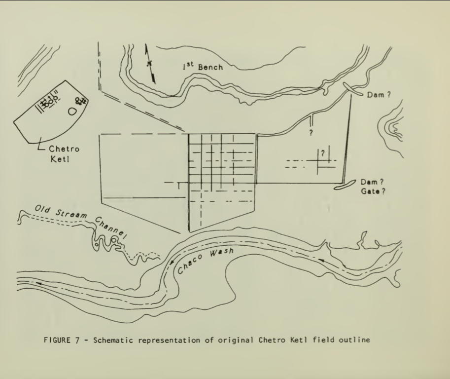
English: This image is a NPS map of the Chetro Ketl fields. |
| Date | |
| Source | Loose, Richard W.; Lyons, Thomas R. (1976), "The Chetro Ketl Field: A Planned Water Control System in Chaco Canyon", in Lyons, Thomas R., Remote Sensing Experiments in Cultural Resource Studies: Non-destructive Methods of Archeological Exploration, Survey, and Analysis, Reports of the Chaco Center, No. 1, United States Department of the Interior, National Park Service, page 152. |
| Author | National Park Service |
Licensing
| This image or media file contains material based on a work of a National Park Service employee, created as part of that person's official duties. As a work of the U.S. federal government, such work is in the public domain in the United States. See the NPS website and NPS copyright policy for more information. |
File history
Click on a date/time to view the file as it appeared at that time.
| Date/Time | Thumbnail | Dimensions | User | Comment | |
|---|---|---|---|---|---|
| current | 23:22, 2 June 2015 | | 1,075 × 904 (415 KB) | Rationalobserver | User created page with UploadWizard |
File usage
The following pages on the English Wikipedia use this file (pages on other projects are not listed):